Monday, September 03, 2018

S.C. needs coherent vision for future By Jim DeMint

Source: http://www.statehousereport.com/2018/07/06/demint-s-c-needs-coherent-vision-for-future/

July 6, 2018

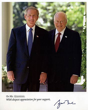
Former U.S. Sen. Jim DeMint at a 2017 meeting.

By Jim DeMint, republished with permission | It’s no secret. South Carolina is bursting with promise. Our breathtaking natural beauty, low cost of living, friendly culture and hard-working people have led to rapid growth in recent years.

But even as we celebrate all that’s good about our state, we must also acknowledge that we face daunting barriers to opportunity that hold our people back from reaching their full potential.

Opportunity is squandered every day as our state government, mired in inertia, incompetence (and sometimes outright corruption) staggers from one crisis to the next. Sadly, the diffuse accountability of our legislatively-dominated system is a barrier to creating a coherent vision for the future.

For example, what is the plan to improve education? Lower taxes? Fix roads? There is none.

Our outdated education system leaves far too many children without the skills they need to succeed in life. Our uncompetitive tax code “necessitates” huge giveaways to attract out of state companies and sticks homegrown businesses with the bill. Despite a massive gas tax hike, our crumbling infrastructure still has no transparent, prioritized strategic plan.

And then there’s the $9 billion V.C. Summer nuclear boondoggle, a vivid example of Columbia’s gaping public policy vacuum. In the absence of credible, independent analysis, part-time legislators with few staff are left to rely on information from cronies and insiders who write legislation that benefits their bottom line…and leave the rest of us picking up the tab.

But as a proud South Carolinian, “While I breathe, I hope.” In each of these challenges, I see tremendous opportunity for us to unite to overcome our challenges and lead a national opportunity revolution.

It starts with bold, proven ideas. We can’t just elect good people and send them into battle armed with nothing but good intentions. We need powerful “idea engines” to map out real solutions, crunch data, learn from other states, convene the right allies and craft the right messages to move reform forward.

Enter Palmetto Promise Institute’s Freedom Agenda, a roadmap to fairness and opportunity for every citizen in our state:

Education Freedom means parent-controlled innovations like Education Scholarship Accounts that enable students to completely customize a K-12 education experience that meets their unique needs. It also means fixing South Carolina’s broken funding formula to get dollars out of programs and bureaucracies and down into classrooms to support teachers and students.

Tax Freedom entails fundamentally reforming our unfair, unstable and uncompetitive tax code by following the tried and true pro-growth principles of a broad base and lower rates. Our neighbors in North Carolina have already done just that and are reaping the benefits. With the highest marginal individual income tax rate in the Southeast, South Carolina simply can’t afford to get left behind.

Energy Freedom starts with cleaning up the V.C. Summer mess by putting South Carolina on a path to get out of the failed, state-owned energy business and allowing for more energy choice like our neighbors in Georgia enjoy.

Healthcare Freedom protects growing innovations like Direct Primary Care that provide transparency in pricing and put doctors and patients – not insurance companies – back in charge of health care decisions. It also means continuing to push Washington away from one-size-fits-all regulation of our insurance market. With Medicaid growth unchecked and crowding out other budget priorities, we must seek new ways to reform this broken program to both rein in costs and better serve the truly vulnerable.

Each of these ideas draws from the practical experience of states across the country, while harnessing independent, data-driven research to customize them to the unique needs of South Carolina. Each of these solutions is grounded in the principles of freedom and opportunity which have been the lifeblood of American greatness. And each of these reforms stand up for the little guy or gal being crushed under the weight of our broken state government.

During my time in Washington I quickly learned that old ways of doing business die hard. But as we proved in the successful fight to eliminate earmarks, change is possible. Even in this age of negativity and division, I believe strong, principled leaders can unite people to move a bold, positive Freedom Agenda forward.

Our battle cry: give us a Palmetto State that is free and fair, where every individual has an opportunity to reach their full, God-given potential. That’s the only path to a happier, healthier, more prosperous South Carolina.

Former U.S. Sen. Jim DeMint, R-S.C., is the founding chairman of Palmetto Promise Institute.

Lava Flow Hazards Zones and Flow Forecast Methods, Island of Hawai‘i By USGS

Source: https://volcanoes.usgs.gov/observatories/hvo/hawaii_lava_flows.html


Lava flows from the Pu‘u ‘Ō‘ō-Kupaianaha eruption sets fire to the Waha‘ula Visitor Center and maintenance shop in Hawai‘i Volcanoes National Park as thin pahoehoe covers the area in 1989.

Lava flows on the Island of Hawai‘i are renowned for their frequent occurrence, relatively easy access, land-building ocean entries, and for Hawaiian names that describe their surface textures—rubbly ‘a‘ā or smooth and sometimes ropey pāhoehoe. Hawaiian lava flows generally advance slowly and can be easily avoided by people. However, lava flows can destroy everything in their paths—rainforests, buildings, roads, utility and communication systems, and whole communities. During the ongoing eruption of Kīlauea Volcano at the Pu‘u ‘Ō‘ō vent, several people have died because of the hazards associated with lava entering the ocean.


A fast-moving ‘a‘ā flow erupted from Mauna Loa in 1950 as it advanced through the forest toward the ocean. During this eruption, a flow reached the ocean (20 km, 12.5 mi) in 3 hours.

The likelihood that future lava flows will interfere with human activity and infrastructure increases as communities and other development encroach on Hawaii's active volcanoes. USGS scientists characterize long-term lava flow hazards based on where and how often past lava inundation has occurred. When a new lava flow erupts, scientists use different methods to estimate where and how quickly it will travel downslope.

Lava-flow hazard zones vary across the Island of Hawai‘i


Lava-flow hazard zones map, Island of Hawai‘i. See Full Map for complete legend.

The first USGS map showing volcanic hazard zones on the Island of Hawai‘i was prepared in 1974 and revised in 1987 and 1992. The latest map divides the island into 9 zones, with lava flows most likely to occur in Zone 1 and least likely in Zone 9. The zones are based on the mapped locations of vents and lava flows, frequencies of past eruptions, written eruption accounts, and oral traditions of Hawaiians (chants and stories about eruptions). The zones also take into account larger topographic features that will affect the paths of future flows. The hazard boundaries are approximate, and the change in the degree of hazard is generally gradual rather than abrupt.

The probability of future lava flows is not the same for all areas of the Island of Hawai‘i. The long-term lava-flow threat is greatest on Kīlauea and Mauna Loa, the two most active volcanoes, followed by Hualālai.

The 1992 lava flow hazard zone map is also available as a downloadable KMZ file, and you can read more about viewing it in Google Earth or as a GIS layer in the June 10, 2005, Volcano Watch article.

Lava flow forecasts based on past flows and topography

Hawaiian Volcano Observatory (HVO) scientists use two methods to forecast the path of a lava flow: broad inundation zones based on the mapped pathways of previous lava flows, and steepest descent paths based on a digital elevation model of a volcano's topography or surface. Estimates of lava flow travel times are based on known advance rates of active flows and earlier flows from within the same area.


Past lava flows define inundation zones: Mauna Loa

Lava inundation zone map, Mauna Loa, Hawai‘i. Excerpt from Trusdell et al., 2002

HVO scientists have mapped more than 500 individual lava flows on Mauna Loa Volcano. These flows originated from vents in the summit area, rift zones, and flanks of the volcano. Their locations help identify the approximate pathways for future flows that erupt in similar locations. Mauna Loa is divided into 9 inundation zones, each including potential future vent locations and the corresponding downslope areas that could be buried if future lava flows reached the ocean. When an eruption begins, the zones can be used to quickly identify communities, infrastructure, and roads that could be affected by lava flows from the erupting vent(s). However, it is likely that only part of a zone will be buried in a single eruption.


Surface topography determines steepest descent paths

A lava flow moves down the flank of a volcano under the influence of gravity, similar to how water flows downhill through gullies, channels, and valleys. Such low areas can be described as steepest descent paths for flowing water. In the absence of obvious water drainages on active Hawaiian shield volcanoes, scientists calculate steepest descent paths for flowing lava using computer software and digital topographic maps called digital elevation models (DEMs); the paths are shown as lines on a map. DEMs are not perfect representations of the earth's surface, however, which means that steepest descent paths are only approximate. Steepest descent paths in the Puna District, Island of Hawai‘i, published in 2007 were used to forecast paths for a lava flow that spread eastward from the Pu‘u ‘Ō‘ō vent on the East Rift Zone of Kīlauea Volcano in 2014-2015.


Lava flow travel times based on actual flow rates

Travel time estimates for a lava flow are based on the actual advance rate of the flow and, if known, the overall advance rate of earlier lava flows that passed through the same location. However, this method of forecasting travel time is highly uncertain, because factors that control flows are constantly changing—eruption rate, ground slope the flow is moving over, and complex behavior of ‘a‘ā and pāhoehoe flows.

Measured advance rates on the Island of Hawai‘i are as fast as 9.3 km (5.8 mi) per hour for an ‘a‘ā flow erupted from Mauna Loa in 1950, which is slightly slower than typical human jogging speed. Pāhoehoe lava flows typically move more slowly, less than a few hundred meters (or yards) per hour or day. The distance a flow travels ultimately depends on the eruption rate and duration, slope, and evolution of the flow field, including whether and how lava tubes, lava channels, or subsequent breakouts develop and progress.


Page modified: 2017-05-10 10:55:28